

| C. I. R. P. - Cambria Icefield Research Project - Page Index | ||
Menu & Links |
|
|
| Introduction to C.I.R.P. | ||
Thanks for Coming to the CIRP page of Return to Misty Moorings. Everything here is FREEWARE, just respect our copyright statement. Download, put it in to FSX or P3D and ENJOY!
| ||
| Back to Top | ||

| Introductory Flight to the Glaciers | ||
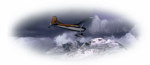
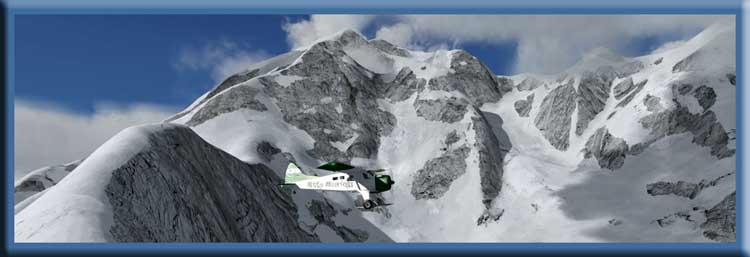
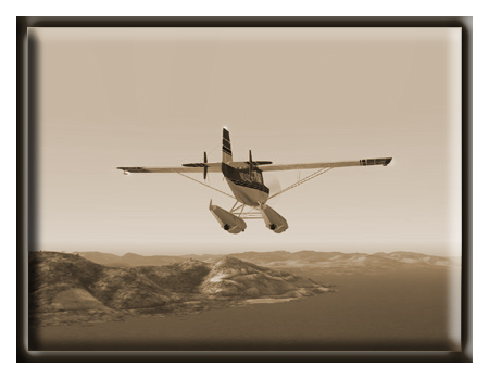
Introductory Flight to the Glaciers You board your flight at PAKT Ketchikan and fly low and slow across the beautiful Misty Fjords. Once you cross the broad Behm Canal, you will see the snow-capped mountains in the distance ahead. You will then get your first look at the RTMM glacier area, flying to the crest of the Chicamin glacier and then down the other side to land at the Summit Ice Station (PF48). You can fly safely at 1200 feet until you approach the mountains. This is a "flight seeing" tour so you can use the autopilot and sit back and enjoy the scenery. All you need to do is take off, watch your altitude, and land on the glacier. There is a Welcome Center and Lodge there where you can take bus tours out onto the ice. This flight plan demonstrates the unique geographical diversity of the RTMM flying area. From low mountains and beautiful fjords and forests to the high, gleaming ice of the glaciers. There are many adventures waiting for you with the ice stations. Land-based tours out onto the ice checking many of 85 Weather/Research instruments and there are air operations and tours that take you to the ten different ice stations. This flight only begins your journey. . . . . |
||
| Back to Top | ||
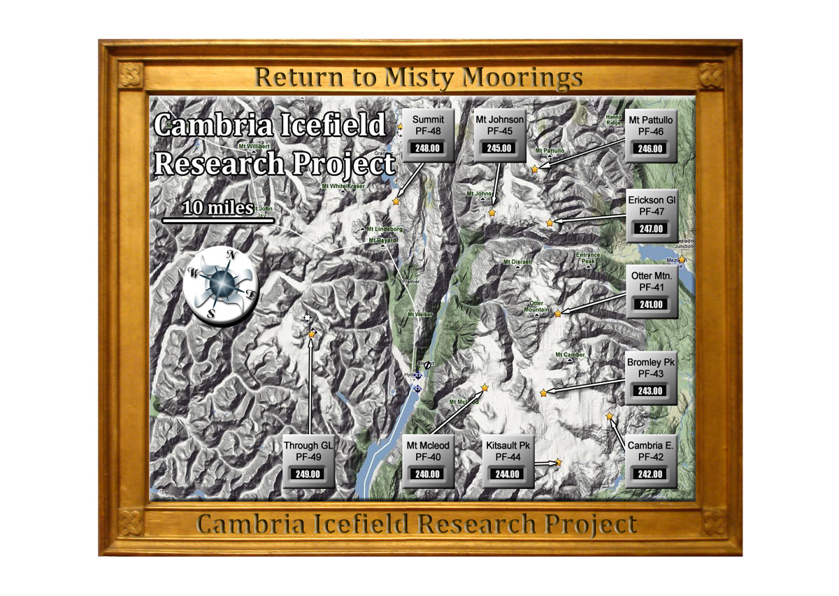
| The C.I.R.P. Map | ||
Click on Map for Larger Version - Click HERE for Google Earth Map |
||
| Back to Top | ||
| CIRP Pilots' Briefing | ||
Camp Designations - There are 10 camps in all, designated PF-40 to PF-49. Each of these will have a name based on a glacial feature nearby. NDBs - Each camp hosts an NDB good for a range of about 20km (12 Miles), which means you'll have to first VFR your way into the proximity of a camp before the NDB becomes active. The NDB frequencies are all a variation of "24*.0" with the "*" being the camp number designation, For example, the PF45 NDB frequency is 245.0 etc. If you get lost, these NDB's will show up on the FSX GPS, but of course experienced bush pilots need no such help Fuel - There are no aviation fuel stations in the glacial area around Stewart. Bring what you need. Airstrip and Taxi Precautions - All of the airstrips, taxi and turnaround areas are all delineated by "ground textures" that feature tire tracks and ground wear. Try to stay in these areas! Straying away from these "worn" areas is not recommended because you will soon come upon the default "ice" ground textures, which have very little to no braking characteristics. So if you overshoot a runway or taxi area stopping or turning around may be difficult to impossible. In such cases your engine and rudder are your only friends. Good Luck! To see details on individual Ice Stations, Click HERE |
||
| Back to Top | ||
| C.I.R.P. Air Operations | ||
CIRP is a natural extension of Return to Misty Moorings, taking advantage of the vast glacial area above Stewart, BC. Now and then you will see a road, but they are few and far between. On the vastness of the icefields, there are no roads and the only way to effectively reach all of the locations is by air. The two main aircraft modes being fixed wing (airplane) and helicopter. Step one in designing a package like this for the flight sim community is creating the individual, and in this case outlying packages. These are placed where ice stations would be placed in order to study the glaciers, their topography, their movement and their "character." Step two is "doing something" with the scenery locations. For CIRP, there are two "Operations" tables ... one for Air Operations, the second for Land Operations. These will include flight plans and interesting uses for the carefully placed and designed scenery packages. |
||
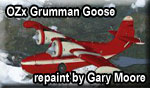
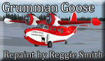
Airplane CIRP Repaints The CIRP aircraft that needs to be used for the glaciers is one that has the power and lift configuration for near STOL conditions. Most of the time skis will be the best choice, but tundra wheeled aircraft also work well on the ice. There are three places where amphibians and float plans can land, one at Summit Lake, another at the Rest & Recreation Lodge and the third at the Stewart Operations Base. Your aircraft should be equipped with an ADF as all ice stations have NDBs. Also a GPS is almost mandatory in these conditions. To download CIRP repaints, click on an image below:
|
||
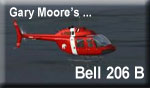
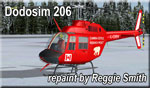
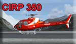
Helicopter CIRP Repaints: The CIRP Helicopter is critical to the air operations for the project. There are 18 helipads from different sizes and improvised landing zones (LZ) located out over the glaciers in some very precarious landing conditions. For the RTMM/CIRP fans who enjoy the helicopters, this group of scenery additions will test your skills. The winds and weather in general are rarely "favorable" and should always be taken seriously on approach/departure to the stations and mountain based landing zones. High altitude approved helicopters, providing enough power, are best to handle both successfully. To Download a CIRP Repaint, click on an image below:
|
||
Routes and Dispatches for Air Operations (FAQ Using Dispatcher's Ribbons)
Fixed Wing and Heli Operations
Helicopter (only) Operations
Auto Routes (for bad weather) - autopilot-friendly routes for gps to be used when weather is difficult. Follow the gps route or use the autopilot ... you must adjust the altitude. Misc Air Traffic Files for CIRP
|
||
| Back to Top | ||

| C.I.R.P. Ground Operations | ||
CIRP is a flight sim site with an added "ground" dimension. While working on the locations, we discovered how fascinating it is to actually work on the glacier at land level. So we decided to create some interesting things for our fans to do "down on the ice." Why Maintenance Runs and Land Routes? When there are active Ice Stations ... the work is never done. Because of the severe weather, the instrumentation placed to monitor the glacial activity can fail interrupting data streams for critical research. Many are powered with solar panels and, of course, snow covering a solar panel will shut down the sensor. There are also ice core drilling teams out on the ice as well as other scientific expeditions. The following two vehicles are recommended but not mandatory:
Download the CIRP-modified vehicle HERE
|
||
Routes and Maintenance Runs (for land vehicles) |
||
A. Summit Ice Station Dispatches ... (Included in Summit Ice Station Zip)
NOTAM: FSDiscover@ dat file for "CIRP Routes & Markers" ... see "map room" |
||
B. Soule Glacier Routes (Updated 01.20.2018)
NOTAM: FSDiscover! Dat file for "CIRP Routes & Markers" ... see "map room" |
||
| Back to Top | ||

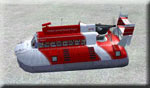 The CIRP Hovercraft We have found the hovercraft to be the most versatile vehicle for the glaciers. Small light planes and helicopters are useful too, but sometimes cannot land or go where the hovercraft can go. For that reason, the hovercraft is the preferred mode of transportation on the ice. We recommend the Hama's Hovercraft and we have adjusted the panel to fit the CIRP scenario. All stations have an NDB, so all panels have an ADF. The dispatches can be found with the scenery location. Click on the name of the dispatch to download the 'flight plan". Click on the "map" to see a map of the route. Hovercraft by Hama, Repaint by Gary Moore. This has been updated for P3D V4.
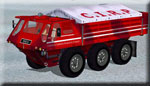 The "Stolly": The hama Stalwart vehicle is another perfect vehicle for work on the glaciers. The Stalwart could carry 5 tonnes of stores, or tow 10 tonnes. In the water it was driven by vectored thrust water-jet propulsion units at about 6 knots. The drive system including the all-wheel drive, multiple gearboxes, and the water propulsion units was complex and needed a lot of maintenance. When the amphibious qualities become unnecessary, it was common for the water jets to be removed to reduce weight and maintenance. Stalwart by Hama, Repaint by Gary Moore.
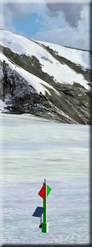

| The Ice Stations - Scenery Files | |
PF40 - Mt. McLeod Ice Station ICAO PF40 - NDB: 240.00 KHz - RWY 29/10 Start: N55 54.35 ... 129.50.19 ... Mag: 141 (Ice) |
|
Mt. McLeod Ice Station is just a short flight from Stewart, BC (CZST). There is an away team nearby that is measuring the rate of travel of the glaciers near the ice station. At the airstrip, pilots are needed to ferry supplies to and from the ice station. Weather conditions are constantly changing up here so plan accordingly. This airstrip is long enough for many types of aircraft including C-130 "Hercules" who set the base up for the winter and return during the spring to help recover science experiments and add new installation facilities where needed. This station serves as the main supply point for all the smaller stations in the project. Tune in 240.0 and you'll activate the NDB frequency on your ADF equipped aircraft.
|
|
| Back to Top | |
PF41 - Otter Mountain Ice Station ICAO PF41 - NDB Frequency: 241.00 KHz - Rwy 03/21 Start: N56 0.49 ... W129 37.92 ... Mag: 204 Alt: 5946 (Ice) |
|
Located on the northern arm of the Cambria Icefield, and 5 km east of Bitter Creek sits Otter Mountain. This is the highest peak in the Cambria Icefield, and in fact one of the most prominent peaks in all of British Columbia. The ice station sits on a frozen plateau below and is always a challenge for aviators. Look for a snowcat field team near the edge of the glacier conducting experiments. "Amigo's Cantina" is located here and when "Wild Bill" ends his day flying helicopters around the ice, this is the spot he chooses to unwind at. The beer is always ice cold at "Amigo's". Tune in 241.0 and you'll activate the NDB frequency on your ADF equipped aircraft.
|
|
| Back to Top | |
PF42 - Cambria East Ice Station ICAO PF42 - NDB Frequency: 242.00 KHz - Rwy 14/32 Start: N55 53.92 ... 129 40.48 ... Mag: 205 Alt: 5116 (Ice) ... WP: R099A |
|
Nestled on the edge of a glacier, Cambria East is one of the most scenic locations in the Cambria Icefield Research Project. Looking east, after the sun rises it keeps this outpost just a little bit warmer than the rest. Look for a snowcat expedition conducting weather and wind readings near the eastern edge of the glacier. "Bandit" and "Trooper" are the two camp German Sheperds who are always the first to welcome visitors here. Tune in 242.0 and you'll activate the NDB frequency on your ADF equipped aircraft.
|
|
| Back to Top | |
PF43 - Bromley Peak Ice Station ICAO PF43 - NDB Frequency 243.00 KHz - Rwy 13/31 Notam: AI Package is HERE Start: N55 53.92 ... 129 40.48 ... Mag: 206 Alt 5116 (Ice) |
|
Situated on a saddle between several mountains, a larger airstrip greets aviators here but it's never routine. The weather can change in an instant up here on the ice and pilots report notorious turbulence at Bromley Peak. You'll see two old wooden radar structures here that were utilized by the Canadian military during the cold war. Also look for the nearby expedition near the airstrip. There is also an aircraft that routinely arrives and departs with supplies to the station. You'll see it on the east ramp area. There are also custom sounds utilized here. Please read the included installation document by Xavier. Tune in 243.0 and you'll activate the NDB frequency on your ADF equipped aircraft.
|
|
| Back to Top | |
PF44 - Kitsault Peak Ice Station ICAO PF44 - NDB Frequency 244.00 KHz - Rwy 11/29 Start: N55 47.99 ...: W129 38.17 ... Mag: 350 Alt: 4529 (Ice) |
|
This ice station is parked right up against the base of Kitsault Peak on an open field of ice. It sits near the southernmost edge of a massive ice sheet that's actually moving bit by bit towards the edge and one day, will fall off the side of the peak. Important research is conducted at each of the CIRP locations, but Kitsault is showing more and more detailed information that confirms that the recession of the glaciers in the area is increasing with each year. Look for another away team just east of the station on the glacier. Tune in 244.0 and you'll activate the NDB frequency on your ADF equipped aircraft.
|
|
| Back to Top | |
F45 - Mt. Johnson Ice Station ICAO PF45 - NDB Frequency 245.00 - KHz - Rwy 08/26 Start: N56 9.27 ... W129 48.64 ... Mag: 317 Alt: 4952 (Ice) |
|
This location is not easy to get into or out of. Pilot's here are faced with only one preferred way in and out and not much room for error if something doesn't go according to plan. Add to that, it's a short airstrip on the ice. With a drop off on the east end and a rising slope on the west end. The ends of the airstrip have marker poles to help pilots judge the terrain clearance, but there have been several accidents at Mt. Johnson. The station is a small facility with not much in comforts. Still, it's a necessary place that pilots will need to help re supply. Just be sure to have the proper airspeed on approach because you don't want to be landing with a lot of speed here. Tune in 245.0 and you'll activate the NDB frequency on your ADF equipped aircraft.
|
|
| Back to Top | |
PF46 - Mt. Pattullo Ice Station ICAO PF46 - NDB Frequency 246.00 KHz - Rwy 13/31 Start: N56 12.75 ... W129 40.96 ... Mag: 91 Alt: 6159 (Ice) |
|
Let me tell you a strange little story! Mt. Pattullo Ice Station was one of the first facilities built in the Cambria Icefield Research Project, better known as CIRP. Later, it was decided to add an airstrip but the first two locations that had any possibility near the station were found to be too dangerous. So, the decision was made to add the airstrip closer to the station. Pilots complained that the airstrip was in line with the facility, was too short and would be too risky in that configuration. But management decided to give that layout the go ahead. It was a decision that they would soon regret. There were avalanches, snowcat accidents, and then the forewarned crash of an airplane that took several lives. (It was very difficult trying to remove the wreck). Many others incidents seemed to strike the remote outpost. Due to the constant howling winds, some scientists even had to be removed after going crazy. These circumstances lead to the base being abandoned and forgotten. Since then it's been left alone. Now, many years later, CIRP is completed and all stations, except Mt. Pattullo, are open and active with various scientific experiments taking place on the ice. However, there is the matter of the old base near Mt. Pattullo that nobody want's to talk about. There are even rumors and sightings of a wild beast that some call an "Abominable Snowman" that uses the old buildings for shelter and terrorizes anyone curious enough to venture near the worn down facility. Nevertheless, management decided recently to try and recover any asset's that might be usable from the old base. There is even discussion of finding a new home for the CIRP Team near Mt. Pattullo. So several CIRP pilots were sent on scout missions in the area and our famous pilot and discoverer Brad Allen took a plane, a Remington rifle, a camera, and a bottle (?!) and flew away to land at the base and see what he can find. No one heard from him for several hours and communications were lost. Many feared the worst. But soon, the sound of his aircraft could be heard and when he came back, the only words he says with a smile are: "There isn't any Yeti !? Humff ! Not one that I could find anyway!! But I did see some interesting tracks in the snow near the base. Nothing like I've ever seen before." There was a twinkle in his eye. Was he just trying to build up the story again? Or was he telling the truth? Only time will tell. Back at Mt. Pattullo, a cabin was built near the pass to allow maintenance for a planned weather station to be installed on the peak. A helipad was added and a ramp between both platforms. But, some new accidents have happened. Several people were knocked off the ramp by the ever persistent strong wind. So a new ramp was added and reconstruction of the ice station still continues. More instruments were recently placed at the peak... ice research instruments, not weather ones! So it looks like there could be a new rebirth at Mt. Pattullo. But many questions still linger. Some call this place cursed. But there is still a functional NDB at the airstrip and pilots are being asked to ferry small loads out to Mt. Pattullo. So who know's what the future holds at this god forsaken place. Tune in 246.0 and you'll activate the NDB frequency on your ADF equipped aircraft.
|
|
| Back to Top | |
PF47 - Erickson Glacier Ice Station ICAO PF47 - NDB Frequency 247.00 KHz - Rwy 16/34 Start: N56 8.56 ... W129 39.56 Mag: 303 Alt: 6104 (Ice) |
|
This station is not just an airstrip on the ice, it's also a helicopter base, with numerous landing pads made for use in CIRP. Helicopters here are typically based at Stewart during the period of October to March supporting biological, glaciological and geological expeditions. Rotorcraft will also want to scout the nearby peaks in the area for other landing spots that will challenge the pilots abilities. Tune in 247.0 and you'll activate the NDB frequency on your ADF equipped aircraft.
|
|
| Back to Top | |
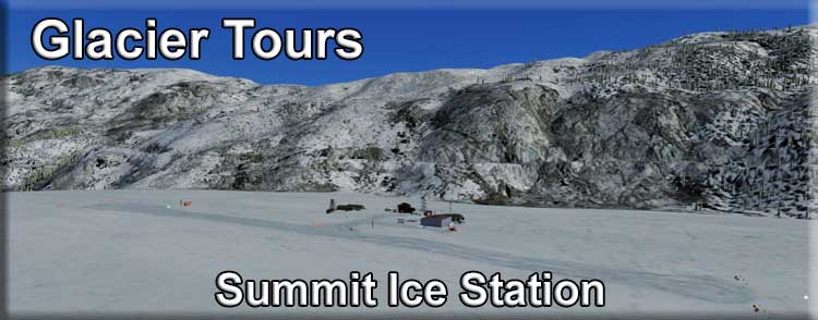
PF48 - Summit Ice Station
ICAO PF48 - NDB Frequency 248.00 KHz - Rwy 16/34 Start: N56 10.11 ... W130 3.82 ... Mag: 046 Alt: 2916 Ft |
|
The Summit Ice station is located about 1 mile SSE of Summit Lake. It can be found on a 326 heading from Stewart, BC for 14.9 miles. This facility can handle almost any small to medium aircraft. Float Planes can moor at the dock at Summit Lake and passengers can take a bus ride over the glacier to the Visitor's Center at Summit Ice Station. There is a lighted helipad for helicopters and a 2000 foot ice runway for medium to light fixed wing aircraft. The facility's Visitors Center is geared to give guests an up close look at a working Ice Station. They will be taken on guided tours through the various laboratories and maintenance areas of the facility. There is an observation tower at the visitors center where some fine pictures can be taken of Salmon and Frank Mackie Glaciers. Instruments are placed out on the glaciers, you can go find them using the dispatches in the Glacier Vehicles and Maintenance Dispatches table below. You can also view the brochure for the Glacier Tour from Ketchikan HERE. README here. Tune in 248.0 and you'll activate the NDB frequency on your ADF equipped aircraft. Summit Ice Station Dispatches ... instrument maintenance routes for the hovercraft.
|
|
| Back to Top | |
PF49 - Through Glacier Research Base ICAO PF49 - NDB Frequency 249.00 KHz - Rwy 17/35 Start: N55 58.87 ... W130 17.42 ... Mag: 049 Alt:4480 (Ice) |
|
There is a through glacier (that is a type of Glacier, not its name) that you will find on the Ketchikan sectional aeronautical chart, issue 45 dated April 2005) is about 60 nautical miles on a rough heading of 60 degrees out of Ketchikan. The research scientists up there are investigating glacial flow and global warming and why glaciers flow both ways. But having said that, it's still cold up there, so they need regular supplies of fuel and fresh food, not to mention fuel, booze, newspapers... Oh, forget the booze. They've had a new neighbour arrive recently, One-Eye is his name. He's set up a small cabin just uphill (or should that be "up-glacier"?) from the research station. If you do drop by and supply the researchers, why not take a short hike around the boulders and try a tot of his specially brewed vintage "Elmer #5". It's vintage because he uses three-thousand year old glacial ice for his still. Otherwise his brews are usually fresher than a daisy. Ah yes, and there's another thing or two for you to do while you are up on the glacier. There's an NDB radio beacon and shack on the very high ground to the North and on the western edge of this arm of the glacier. You'll find a small but landable helipad on one rocky peak, but you'll have to walk across the saddle to reach the NDB shack for a visit. ...and on the other side of the researcher's valley, there's a secret listening post, also with a small landing pad for a heli. The main challenge of this addon for Misty Moorings is for you to find the landing sites for the Through Glacier Research Station (both fixed wing and heli can land here) and to find One-Eye's secret distillery and the two radar and radio stations higher up. Fixed wing visitors can land on the glacier itself - the research team will light a couple of fire barrels to point you at the threshold of a cleared ice strip. Tune in 249.0 and you'll activate the NDB frequency on your ADF equipped aircraft.
|
|
| Back to Top | |
 Click to Enlarge
 Click to Enlarge
 CLick to Enlarge
 Click to Enlarge
 Click to Enlarge
 Click to Enlarge
 Click to Enlarge
 Click to Enlarge
 Click to Enlarge
 Click to Enlarge
| Scenery Features and Notes | ||
Here are some of the features you will find in CIRP ...
|
||
| Back to Top | ||
| Credits and Special Thanks! | ||
Credits This project may have come out of one person's head and scribbled onto a piece of paper one day, but it takes a lot of people to bring the dream to fruition.
Special Thanks
|
||
| Back to Top |