

| USFS Cabins, Lighthouses & Oil Rig Platforms | ||
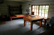
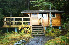
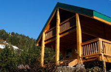
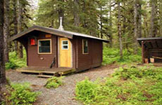
 USFS Cabins |
 Lighthouses Lighthouses
|
 Oil Rig Platforms |
| Page Navigation and Selection Buttons | |||
 |
 |
 |
 |
 |
 |
 |
 |
 |
 |
 |
 |
 |
 |
 |
 |
| References | |||
 |
 |
 |
 |
| Location Quick Finder - For Windows Press CTRL-F and enter Location Name | |||
| Overview: The USFS Cabins, Lighthouses and Oil Rigs | ||
Thanks and Credit to the United States Forestry Service website for the linked information and pictures below. RTMM also has created a picture for each location from an actual screenshot (384 of them). Maps and flight plans were created for ALL cabins. Each location has a mooring or starting point. If you use the map feature in FSX, these coordinates will place you at the best mooring for the location, a magnetic heading starts you out lined up correctly at the location. You can start at a cabin and fly back to an airport of your choice. This gives you maximum flexibility in deciding how you want to use the information. On this page, you will find Installation Instructions and downloads for the following:
All of the cabins on this page (except for 2 and so indicated) are real and actually exist. If you click on the name of the cabin, you will find you have linked to the actual USFS web page that describes the cabin and how to rent it, supplies you will need, etc. For the "rookie" FSX Bush Pilot, flying "the cabins" is great fun and a great learning tool. Each comes with a map so you can see what you trip will look like, each comes with a flight plan that will take you to it by using your GPS and autopilot. And all have a picture of the destination so you can be looking for it as you approach. We hope you enjoy the vast amount of information on this page and visit often for a new flight adventure. If you find a broken link, let us know (contact@mistymoorings.com). There are over 1000 links on this page, so a broken link can happen now and then.
Enjoy the journey .... |
||
| Back to Top | ||
| Installation and Instructions | ||
Most of the USFS Cabins are part of the PFJ, Tongass Fjords X and SAK Scenery Packages. However, there are over 90 cabin locations missing. RTMM has created scenery locations for each of the missing locations and added them for you in the zip file (with installation instructions and NOTAMs) that you can download below:
NOTAM: Project statistics: There are a total of 231 cabins that have been created by Tongass X, PFJ, SAK and RTMM. Of those RTMM created 115 locations. Each location has a screen shot, each has a map, each has a flight plan. With links to the USFS for each location, the total number of links for the project is 924. |
||
| Back to Top | ||
| Legend for Tables | ||
! Freezes in Winter
Structure Location = The exact location of the structure and it's altitude (Alt) Mooring (start) Point = Positions your aircraft at the dock for the structure - The last digits are for the magnetic heading you should use. Example: N57 25.57 / W133 55.64 - 148* ... your Magnetic Heading should be 148. |
||
| Back to Top | ||
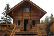
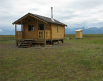
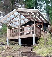
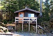
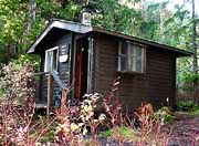
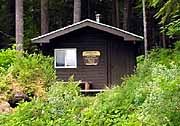
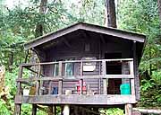
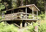
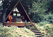
| Admiralty National Monument | ||
|
|
|
 Little Shaheen
 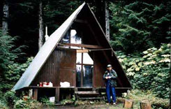 Pybus Bay
 | Cabins | ||
Cabin Name |
Structure Lat/Long and Alt |
Start Long/Lat and Heading |
| Admiralty Cove S (P) (M) (F) | N58 10.59 / W134 33.72 - 43' | N58 10.56 / W134 33.75 - 024* |
| Big Shaheen R (P) (M) (F) | N57 42.10 / W134 16.21 - 300' | N57 42.08 / W134 16.25 - 251* |
| Church Bight T (P) (M) (F) | N57 25.52 / W133 55.62 - 66' | N57 25.57 / W133 55.64 - 148* |
| Distin Lake R (P) (M) (F) | N57 37.59 / W134 24.10 - 300' | N57 37.61 / W134 24.07 - 195* |
| East Florence R (P) (M) (F) | N57 48.43 / W134 35.29 - 114' | N57 49.45 / W134 35.31 - 125* |
| Hasselborg Creek R (P) (M) (F) | N57 39.46 / W134 15.17 - 281' | N57 39.49 / W134 15.15 - 180* |
| Jim's Lake ! T (P) (M) (F) | N57 34.96 / W134 16.33 - 217' | N57 34.95 / W134 16.33 - 334* |
| Lake Alexander R (P) (M) (F) | N57 40.19 / W134 11.11 - 317' | N57 40.18 / W134 11.10 - 312* |
| Lake Kathleen R (P) (M) (F) | N57 54.17 / W134 38.59 - 499' | N57 54.42 / W134 39.00 - 114* |
| Little Shaheen T (P) (M) (F) | N57 42.10 / W134 16.24 - 300' | N57 42.07 / W134 16.24 - 338* |
| North Young Lake S (P) (M) (F) | N58 08.05 / W134 29.74 - 338' | N58 08.02 / W134 29.75 - 349* |
| Pybus Bay T (P) (M) (F) | N57 20.97 / W134 9.70 - 8' | N57 20.97 / W134 9.68 - 253* |
| South Young Lake S (P) (M) (F) | N58.07.05 / W134 27.97 - 338' | N58 07.05 / W134 28.05 - 071* |
| Sportsman Lake R (P) (M) (F) | N57 38.09 / W134 23.28 - 301' | N57 38.05 / W134 23.25 - 315* |
| Back to Top | ||
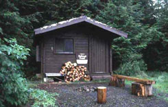
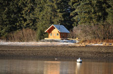
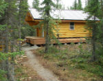
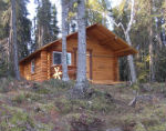
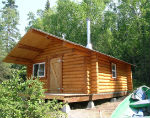
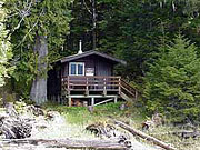
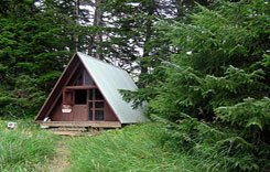
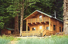
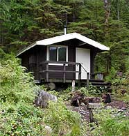
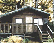
| Chugach National Forest | ||
 Barber Cabin |
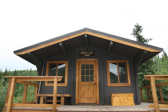 Juneau Lake Cabin |
 Trout Lake Cabin |
| Cabins | ||
Cabin Name |
Structure Lat/Long and Alt |
Start Long/Lat and Heading |
| Aspen Flats R (P) (M) (F) H | N60 22.18 / W149 58.28 - 626' | None - Helicopter Only |
| Barber Cabin S (P) (M) (F) | N60 26.23 / W149 59.20 - 535' | N60 26.28 / W159 59.25 - 130* |
| Beach River R (P) (M) (F) | N60 1.07 / W147 22.54 - 9' | N60 1.06 / W147 22.50 - 302* |
| Caribou Creek R (P) (M) (F) H T | N60 47.02 / W149 40.45 - 1039' | M60 47.04 / W149 40.53 - 095* |
| Coghill Lake S (P) (M) (F) | N61 04.77 / W147 52.26 - 69' | N61 04.71 / W147 52.20 - 320* |
| Crescent Lake S (P) (M) (F) | N60 28.59 / W149 34.45 - 1471' | N60 28.54 / W149 34.47 - 350* |
| Cresent Saddle S (P) (M) (F) | N60 26.71 / W149 30.49 - 1469' | N60 26.72 / W149 30.46 - 203* |
| Crow Pass R (P) (M) (F) H T | N61 03.09 / W149 7.11 - 3481' | N61 03.08 / W149 7.14 - 033* |
| Dale Clemens R (P) (M) (F) H | N60 11.23 / W149 24.56 - 1178' | N60 11.25 / W149 24.56 - 162* |
| Devils Pass R (P) (M) (F) H T | N60 37.29 / W149 45.15 - 2389' | N60 37.28 / W149 45.17 - 033* |
| Double Bay R (P) (M) (F) | N60 27.91 / W146 26.57 - 12' | N60 27.93 / W146 26.60 - 126* |
| East Creek R (P) (M) (F) H T | N60 42.33 / W149 44.93 - 1701' | N60 42.36 / W149 44.95 - 141* |
| Fox Creek R (P) (M) (F) H T | N60 43.55 / W149 42.34 - 1718' | N60 43.56 / W149 42.33 - 175* |
| Goose Bay R (P) (M) (F) | N60 42.88 / W148 13.46 - 8' | N60 42.90 / W148 13.50 - 118* |
| Granite Creek R (P) (M) (F) H T | N60 43.51 / W149 17.70 - 648'' | N60 43.58 / W149 17.50 - 188* |
| Green Island R (P) (M) (F) | N60 17.33 / W147 23.80 - 19'' | N60 17.37 / W147 23.88 - 123* |
| Harrison Lagoon R (P) (M) (F) | N60 59.04 / W148 12.09 - 9' | N60 59.05 / W148 12.12 - 117* |
| Hook Point R (P) (M) (F) | N60 20.85 / W146 17.55 - 31' | N60 20.81 / W146 17.56 - 341* |
| Jack Bay R (P) (M) (F) | N61 00.00 / W146 30.39 - 23' | N61 0.03 / W146 30.38 - 175* |
| Juneau Lake S (P) (M) (F) | N60 34.57 / W149 52.32 - 1319' | N60 34.60 / W149 52.36 - 121* |
| Log Jam Bay R (P) (M) (F) F T H | N59 52.71 / W147 27.23 - 12' | N59 52.69 / W147 27.21 - 295* |
| Lower Paradise Lk S (P) (M) (F) | N60 20.89 / W149 04.40 - 1209' | N60 20.88 / W149 04.37 - 283* |
| Martin Lake S (P) (M) (F) | N60 23.01 / W144 35.38 - 106' | N60 22.98 / W144 35.33 - 303* |
| McKinley Lake S (P) (M) (F) | N60 28.03 / W145 11.48 - 48' | N60 28.00 / W145 11.51 - 359* |
| McKinley Trail R (P) (M) (F) T H | N60 26.78 / W145 12.92 - 109' | N60 26.76 / W145 12.95 - 012* |
| Nellie Martin River R (P) (M) (F) T H F | N59 54.85 / W147 29.99 - 12' | N59 54.86 / W147 30.02 - 128* |
| Paulson Bay R (P) (M) (F) | N60 41.53 / W148 23.93 - 87' | N60 41.64 / W148 23.94 - 161* |
| Pigot Bay R (P) (M) (F) | N60 50.56 / W148 23.81 - 15' | N60 50.57 / W148 23.76 - 210* |
| Port Chalmers R (P) (M) (F) | N60 12.92 / W147 17.56 - 190' | N60 12.89 / W147 17.53 - 302* |
| Power Creek R (P) (M) (F) T H | N60 37.40 / W145 32.36- 479' | N60 37.42 / W145 32.36 - 148* |
| Romig Cabin R (P) (M) (F) | N60 34.27 / W149 52.42 - 1365 | N60 34.30 / W149 52.48 - 124* |
| San Juan Bay R (P) (M) (F) T H | N59 48.25 / W147 53.12 - 19' | N59 48.27 / W147 53.12 - 162* |
| Shelter Bay R (P) (M) (F) | N60 25.45 / W146 39.38 - 8' | N60 25.47 / W146 39.35 - 201* |
| Shrode Lake S (P) (M) (F) | N60 39.42 / W148 18.69 - 104' | N60 39.38 / W148 18.73 - 002* |
| Softuk Bar R (P) (M) (F) T H F | N60 12.15 / W144 38.25 - 12' | N60 11.99 / W144 38.56 - 018* |
| Swan Lake R (P) (M) (F) | N60 36.84 / W149 50.54 - 1423' | N60 36.87 / W149 50.60 - 123* |
| Tiedeman Slough R (P) (M) (F) | N60 25.19 / W145 28.27 - 15' | N60 25.22 / W145 28.32 - 118* |
| Trout Lake S (P) (M) (F) | N60 33.09 / W149 43.71 - 1303' | N60 33.10 / W149 53.80 - 082* |
| Upper Paradise Lk S (P) (M) (F) | N60 22.09 / W149 00.74 - 1350' | N60 22.10 / W149 00.71 - 211* |
| Upper Russian Lake S (P) (M) (F) | N60 21.26 / W149 53.11 - 716' | N60 21.21 / W149 53.18 - 013* |
| West Swan Lake R (P) (M) (F) | N60 37.85 W149 52.82 1432 | N60 37.84 / W149 52.84 - 025* |
| Campgrounds and Shelters | ||
| Cooper Creek Campgrnd R (P) (M) (F) | N60 29.05 / W149 53.09 - 432' | N60 29.10 / W149 53.06 - 180* |
| Porcupine Campgrd R (P) (M) (F) | N60 55.69 / W149 39.47- 68' | N60 55.75 / W149 39.35 - 137* |
| Back to Top | ||
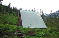
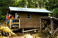
| Craig Ranger District | |||
 Keegan Cove |
 Shipley Bay |
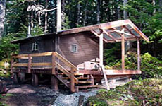 Stanley Creek |
|
Cabin Name |
Structure Lat/Long and Alt |
Start Long/Lat and Heading |
| Kegan Cove P (P) (M) (F) | N55 1.37 / W132 10.32 - 062' | N55 1.34 / W132 10.27 - 281 |
| Kegan Creek P (P) (M) (F) | N55 1.29 / W132 10.84 - 93' | N55 1.29 / W132 10.91 - 070* |
| Point Amagura T (P) (M) (F) | N55 27.27 / W133 21.60 - 9' | N55 27.29 / W133 21.58 - 187* |
| Salmon Lake R (P) (M) (F) | N55 34.92 / W132 40.12 - 158' | N55 34.88 / W132 40.13 - 003* |
| Sarkar Lake Cabin R (P) (M) (F) | N55 57.48 / W133 12.51 - 47.9' | N55 57.45 / W133 12.43 - 283* |
| Shipley Bay T (P) (M) (F) | N56 5.42 / W133 30.38 - 9' | N56 5.40 / W133 30.37 - 356* |
| Staney Creek Cabin T (P) (M) (F) | N55 49.31 / W133 9.36 - 40' | N55 49.28 / W133 9.37 - 343* |
| Sweetwater Lk R (P) (M) (F) | N55 57.40 / W132 55.80 - 23' | N55 57.39 / W132 55.84 - 028* |
| Trollers Cove T (P) (M) (T) (F) | N55 32.12 / W130 31.83 - 284' | N55 32.16 / W130 31.84 - 155* |
| Back to Top | ||
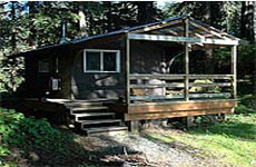
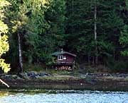
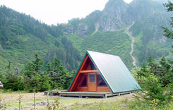
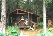
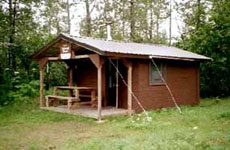
| Hoonah Ranger District | ||
 Eight Fathom Cabin |
 Green Top Cabin |
 Salt Lake Bay |
| Cabins | ||
Cabin Name |
Structure Lat/Long and Alt |
Start Long/Lat and Heading |
| Bohemia Basin Shelter R (P) (M) (F) | N57 59.21 / W136 22.69 - 9' | N57 59.19 / W136 22.68 - 321* |
| Eight-Fathom Cabin R (P) (M) (F) | N58 00.11 / W135 44.76 - 9' | N58 00.10 / W135 44.72 - 263* |
| Greentop Cabin R (P) (M) (F) | N57 51.53 / W136 26.36 - 9' | N57 51.50 / W136 26.35 - 321* |
| Kennel Creek R (P) (M) (F) | N57 54.27 / W135 09.43 - 8' | N57 54.30 / W135 09.41 - 178* |
| Pinta Cove Shelter R (P) (M) (F) | N58 15.96 / W135 45.86 - 9' | N58 15.98 / W135 45.87 - 142* |
| Salt Lake Bay R (P) (M) (F) T H | N57 57.25 / W135 38.20 - 150' | N57 57.25 / W135 38.23 - 064* |
| Back to Top | ||
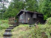
| Juneau Ranger District | ||
 Berner's Bay |
 Dan Moller Dan Moller |
 Denver Caboose Denver Caboose |
| Cabins | ||
Cabin Name |
Structure Lat/Long and Alt |
Start Long/Lat and Heading |
| Denver Caboose S (P) (M) (F) H | N59 33.15 / W135 7.43 - 1875' | N59 33.16 / W135 7.38 - 157* |
| Eagle Glacier S (P) (M) (F) | N58 34.37 / W134 45.05 - 215' | N58 34.39 / W134 45.00 - 230* |
| East Turner Lake S (P) (M) (F) | N58 18.78 / W133 47.51 - 81' | N58 18.77 / W133 47.53 - 021* |
| John Muir S (P) (M) (F) H T | N58 24.54 / W134 41.90 - 1511' | N58 24.54 / W134 41.88 - 285* |
| Katzehin River Cabin S (P) (M) (F) H T | N59 12.65 / W135 19.16 - 9' | N59 12.63 / W135 19.20 - 028* |
| Laughton Glacier S (P) (M) (F) H T | N59 32.81 / W135 05.51 - 2137' | N59 32.81 / W135 05.48 - 062* |
| Peterson Lake S (P) (M) (F) | N58 26.19 / W134 44.15 - 730' | W135 05.48 / W134 44.09 - 200* |
| Taku Glacier S (P) (M) (F) | N58 31.04 / W133 45.94 - 24' | N58 31.007 / W133 46.05 - 094* |
| West Turner Lake S (P) (M) (F) | N58 18.64 / W133 57.29 - 93' | N58 18.61 / - 322* |
| Windfall Lake S (P) (M) (F) | N58 30.53 / W134 43.46 - 114 | N58 30.49 / W134 43.47 - 011* |
| Back to Top | ||
| Kenai Wildlife Refuge | |||
 Kelly Lake |
 Maclain Lake |
 Snag Lake |
 Pincher Creek |
| Cabins | ||
Cabin Name |
Structure Lat/Long and Alt |
Start Long/Lat and Heading |
| Big Bay R (P) (M) (F) | N60 9.11 / W150 51.08 - 123' | N60 9.12 / W150 51.11 - 101* |
| Big Indian Creek R (P) (M) (F) H T | N60 52.80 / W149 57.00 - 165' | N60 52.80 / W149 56.97 - 250* |
| Caribou Island S (P) (M) (F) | N60 14.26 / W151 3.76 - 123' | N60 14.23 / W151 03.77 - 348* |
| China Poot Lake S (P) (M) (F) | N59 32.50 / W151 12.00 - 179' | N59 32.51 / W151 12.04 - 091* |
| Dolly Varden Lake R (P) (M) (F) | N60 42.86 / W150 46.47 - 270' | N60 42.82 / W150 46.41 - 293* |
| Doroshin Bay S (P) (M) (F) | N60 25.56 / W150 8.41 - 257' | N60 25.56 / W150 08.51 - 064* |
| Engineer Lake R (P) (M) (F) | N60 28.98 / W150 19.74 - 310' | N60 28.96 / W150 19.70 - 291* |
| Lake Emma R (P) (M) (F) | N60 07.44 / W150 33.44 - 1040' | N60 07.48 / W150 33.47 - 140* |
| McLain Lake R (P) (M) (F) | N60 51.52 / W150 34.06 - 169' | N60 51.54 / W150 34.07 - 146* |
| Mid Timber Lake S (P) (M) (F) | N60 04.78 / W143 21.26 - 22' | N60 4.77 / W143 21.20 - 272* |
| Nurses S (P) (M) (F) | N60 18.04 / W151 01.75 - 152' | N60 18.00 / W151 01.75 - 343* |
| Pincher Creek R (P) (M) (F) H T | N60 54.23 / W150 12.13 - 30' | N60 54.23 / W150 12.10 - 267* |
| Pipe Creek S (P) (M) (F) | N60 11.59 / W150 45.19 - 127' | N60 11.56 / W150 45.23 - 005* |
| Snag Lake R (P) (M) (F) | N60 49.11 / W150 40.96 - 192' | N60 49.13 / W150 40.97 - 150* |
| Trapper Joe S (P) (M) (F) | N60 45.93 / W150 04.49 - 301' | N60 45.91 / W150 04.51 - 016* |
| Upper Ohmer R (P) (M) (F) | N60 27.37 / W150 17.68 - 495' | N60 27.35 / W150 17.67 - 321* |
| Vitus Lake S (P) (M) (F) | N60 7.38 / W143 18.61 - 58* | N60 7.43 / W143 18.66 - 045* |
| Vogel Lake R (P) (M) (F) | N60 59.32 / W150 26.12 - 133' | N60 59.32 / W150 26.05 - 243* |
| Back to Top | ||
| Ketchikan - Ranger District | |||
 Anchor Passage |
 Blind Pass |
 Heckman Lake |
 Jordan Lake |
| Cabins | ||
Cabin Name |
Structure Lat/Long and Alt |
Start Long/Lat and Heading |
| Anchor Pass P (P) (M) (F) | N55 58.35 / W131 23.89 - 9' | N55 58.33 /W131 23.96 - 031* |
| Bakewell Lake R (P) (M) (F) | N55 15.45 / W131 40.27- 9' | N55 15.44 / W131 40.24 - 294* |
| Blind Pass P (P) (M) (F) | N55 53.59 / W131 38.98 - 9' | N55 53.64 / W131 39.04 - 126* |
| Fish Creek P (P) (M) (F) | N55 23.47 / W131 11.78 - 56' | N55 23.47 / W131 11.84 - 070* |
| Heckman Lake P (P) (M) (F) | N55 35.08 / W131 32.53 - 197' | N55 35.09 / W131 32.46 - 223* |
| Helm Bay P (P) (M) (F) (S) (T) | N55 37.71 / W131 58.62 - 8' | N55 37.72 / W131 58.58 - 218* |
| Helm Creek P (P) (M) (F) | N55 39.06 / W131 58.33 - 9' | N55 39.09 / W131 58.85 - 095* |
| Jordan Lake P (P) (M) (F) | N55 35.88 / W131 33.81 - 71' | N55 35.90 / W131 33.77 - 204* |
| McDonald Lake P (P) (M) (F) | N55 56.16 / W131 48.51 - 51' | N55 56.15 / W131 48.49 - 307* |
| Patching Lake P (P) (M) (F) | N55 37.10 / W131 29.11 - 314' | N55 37.09 / W131 29.14 - 045* |
| Phocena Bay P (P) (M) (F) (T) (S) | N55 10.58 / W131 48.28 - 9' | N55 10.61 / W131 48.33 - 109* |
| Plenty Cutthroat P (P) (M) (F) | N55 49.56 / W131 27.10 - 156' | N55 49.54 / W131 27.09 - 320* |
| Red Alders Cabin # P (P) (M) (F) | Destroyed by weather | |
| Reflection Lake P (P) (M) (F) | N56 0.66 / W131 34.03 - 327' | N56 0.64 / W131 34.08 - 036* |
| Southeast Heckman P (P) (M) (F) | N55 34.39 W131 31.48 - 140' | N55 34.42 / W131 31.47 - 162* |
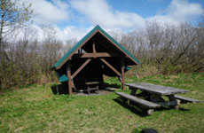
| Shelters | ||
| Lk Shelokum Shelter R (P) (M) (F) | N55 58.59 / W131 38.26 - 389' | N55 58.61 / W131 38.28 - 150* |
| Long Lake Shelter R (P) (M) (F) | N55 54.43 / W131 30.22 - 265' | M55 54.42 / W131 30.25 - 248* |
| McDonald Lake Shelter ** (P) (F) | N55 55.88 / W131 48.31 - 113' | N55 55.82 / W 131 48.33 - 084* |
| Reflection Lk Shelter R (P) (F) | N56 0.20 / W131 33.77 - 346' | N56 0.20 W131 33.81 - 084* |
| Wolf Lake Shelter R (P) (F) | N55 32.49 / W131 36.24 - 301' | N55 32.48 / W131 36.25 - 359* |
| Back to Top | ||
| Misty Fjords Ranger District | |||
 Alava Bay |
 Checats |
 Winstanley Lake |
 Wilson View |
| Cabins | ||
Cabin Name |
Structure Lat/Long and Alt |
Start Long/Lat and Heading |
| Alava Bay P (P) (M) (F) | N55 13.55 / W131 9.32 - 9" | N55 13.54 / W131 9.21 - 254* |
| Beaver Camp P (P) (M) (F) | N55 32.09 / W131 4.91 - 215' | N55 32.07 / W131 4.87 - 283* |
| Big Goat Lake P (P) (M) (F) | N55 32.01 / W130 36.25 - 1793' | N55 32.05 / W130 36.23 - 174* |
| Checats P (P) (M) (F) | N55 29.27 / W130 49.60 - 750' | N55 29.28 / W130 49.55 - 233* |
| Ella Narrows P (P) (F) (M) | N55 29.35 / W131 5.64 - 245' | N55 29.31 / W131 5.63 - 325* |
| Hugh Smith Lake P (P) (M) (T) (F) | N55 5.68 / W130 38.75 - 61' | N55 5.69 / W130 38.71 - 219* |
| Humpback Lake P (P) (M) (F) | N55 1.57 / W130 32.67 - 291 | N55 1.55 / W130 32.64 - 306* |
| Manzanita Lake P(P) (M) (F) | N55 35.34 / W131 6.26 - 169 | N55 35.37 / W131 6.28 - 140* |
| Marguerite Bay Dock R (P) (M) (F) | N55 56.25 / W131 48.42 - 51' | N55 56.25 / W131 48.45 - 051* |
| Wilson Narrows P (P) (M) (F) | N55 28.79 / W130 35.09 - 264' | N55 28.78 / W130 35.13 - 056* |
| Wilson View P (P) (M) (F) | N55 32.12 / W130 31.83 - 256' | N55 32.16 / W130 31.84 - 151* |
| Winstanley Island P (P) (M) (F) | N55 27.26 / W130 54.33 - 9' | N55 27.23 / W130 54.34 - 001* |
| Winstanley Lake P (P) (M) (F) | N55 25.50 / W130 48.79 - 432 | N55 25.48 / W130 48.82 - 025* |
| Shelters | ||
| Nooya Lake R (P) (M) (F) (D) | N55 37.47 / W130 43.44 - 373' | N55 37.44 / W130 43.44 - 337* |
| Punchbowl Lake R (P) (M) (D) | N55 31.74 /W130 45.09 - 625 | N55 31.75 / W130 45.05 - 222* |
| Manzanita Bay P (P) (M) (F) | N55 35.14 / W130 58.39 - 21' | N55 35.06 / W130 58.25 - 284* |
| Winstanley Lake P (P) (M) (F) | N55 25.44 / W130 50.87 - 432' | N55 25.47 / W130 50.88 - 157* |
| Back to Top | ||
| Petersburg Vicinity Cabins | ||
 Devil's Elbow Devil's Elbow |
 DeBoer Lake DeBoer Lake |
 Swan Lake Swan Lake |
| Cabins | ||
Cabin Name |
Structure Lat/Long and Alt |
Start Long/Lat and Heading |
| Beecher Pass R (P) (M) (F) | N56 35.05 / W133 03.07 - 214' | N56 35.05 / W133 03.05 - 281* |
| Big John Bay R (P) (M) (F) | N56 50.75 / W133 41.39 - 9' | N56 50.75 / W133 41.44 - 066* |
| Breiland Slough R (P) (M) (F) | N56 38.28 / W133 09.62 - 9' | N56 38.31 / W133 09.62 - 168* |
| Cascade Creek R (P) (M) (F) | N56 59.77 / W132 47.10 - 7' | N56 59.78 / W132 47.12 - 118* |
| Castle Flats R (P) (M) (F) | N56 38.77 / W133 15.07 - 7' | N56 38.79 / W133 15.02 - 215* |
| Castle River R (P) (M) (F) | N56 38.60 / W133 15.61 - 34' | N56 38.56 / W133 15.50 - 289* |
| Devil's Elbow T (P) (M) (F) | N56 38.65 / W133 43.37 - 8' | N56 38.63 / W133 43.38 - 327* |
| deBoer Lake T (P) (M) (F) | N57 5.70 / W132 56.60 - 1422' | N57 5.71 / W132 56.58 - 192* |
| Harvey Lake R (P) (M) (F) | N56 33.88 / W133 3.51 - 126' | N56 33.85 / W133 3.48 - 304* |
| Kadake Bay R (P) (M) (F) | N56 47.00 / W133 59.27 - 12' | N56 47.03 / W133 59.26 - 166* |
| Kah Sheets Bay R (P) (M) (F) | N56 31.85 / W133 8.53 - 9' | N56 31.81 / W133 08.51 - 318* |
| Kah Sheets Lake T (P) (M) (F) | N56 33.06 / W133 11.30 - 131' | N56 33.09 / W133 11.32 - 124* |
| Petersburg Lk Cabin T (P) (M) (F) | N56 52.14 / W133 10.18 - 80' | N56 52.12 / W133 10.20 - 025* |
| Portage Bay R (P) (M) (F) | N56 57.24 / W133 16.74 - 8' | N56 57.22 / W133 16.78 - 026* |
| Ravens Roost R (P) (M) (F) H | N56 45.53 / W132 55.98 - 1599' | N56 45.51 / W132 56.07 - 049* |
| Salt Chuck East R (P) (M) (F) | N56 52.10 / W133 19.03 - 8' | N56 52.08 / W133 19.05 - 005* |
| Spurt Cove R (P) (M) (F) | N57 2.17 / W132 52.61 - 7' | N57 2.15 / W132 52.61 - 341* |
| Swan Lake T (P) (M) (F) | N57 1.83 / W132 41.61 - 1493' | N57 1.86 / W132 41.61 - 163* |
| Towers Arm R (P) (M) (F) | N56 50.35 / W133 22.31 - 8' | N56 50.36 / W133 22.28 - 217* |
| West Point R (P) (M) (F) | N57 0.46 / W133 20.13 - 8' | N57 0.43 / W133 20.12 - 334* |
| Back to Top | ||
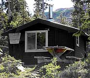
| Sitka Ranger District | ||
|
|
|
 Allan Point
 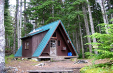 Shelikof
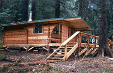 Salmon Lake
 | Cabins | ||
Cabin Name |
Structure Lat/Long and Alt |
Start Long/Lat and Heading |
| Allan Point Cabin T (P) (M) (F) | N57 14.55 / W135 23.88 - 9' | N57 14.51 / W135 23.85 - 312* |
| Appleton Cove R (P) (M) (F) F | N57 27.3808 / W135 15.5568 | N57 27.3808/W135 15.5568 -31.9* |
| Avoss Lake Cabin T (P) (M) (F) | N56 42.31 / W134 55.58 - 750' | N56 42.30 / W134 55.69 - 073* |
| Baranof Lake R (P) (M) (F) | N57 5.11 / W134 51.70 - 120' | N57 5.12 / W134 51.66 - 220* |
| Brent's Beach R (P) (M) (F) T F | N57 8.28 / W135 33.88 - 9' | N57 8.29 / W135 33.85 - 197* |
| Davidof Lake R (P) (M) (F) | N56 37.13 / W134 50.22 - 698' | N56 37.15 / W134 50.21 - 005* |
| Fred's Creek R (P) (M) (F) | N57 03.88 / W135 36.33 - 8' | N57 03.89 / W135 36.35 - 115* |
| Goulding Lake T (P) (M) (F) | N57 48.96 / W136 10.19 - 223' | N57 48.96 / W136 10.21 - 054* |
| Kanga Bay R (P) (M) (F) | N56 52.78 / W135 20.44 - 8' | N56 52.82 / W135 20.38 - 202* |
| Kook Lake T (P) (M) (F) | N57 39.88 / W135 0.59 - 48.3' | N57 39.89 / W135 0.56 - 217* |
| Lake Eva T (P) (M) (F) | N57 24.32 / W135 6.25 - 12' | N57 24.31 / W135 6.23 - 283* |
| Moser Island R (P) (M) (F) F | N57 42.25 / W135 42.88 - 8' | N57 42.27 / W135 42.90 - 124* |
| North Beach R (P) (M) (F) F | N57 10.18 / W135 45.26 - 9' | N57 10.16 / W135 45.28 - 016* |
| Piper Island R (P) (M) (F) F | N57 23.55 / W135 35.67 - 8' | N57 23.57 / W135 35.70 - 123* |
| Plotnikof Lake T (P) (M) (F) | N56 35.40 / W134 51.66 - 309' | N56 35.29 / W134 51.64 - 314* |
| Redoubt Lake R (P) (M) (F) | N56 55.38 / W135 08.01 - 80' | N56 55.35 / W135 08.09 - 029* |
| Salmon Lake T (P) (M) (F) | N56 34.92 / W132 40.13 - 57' | N56 57.68 / W135 08.98 - 047* |
| Samsing Cove R (P) (M) (F) | N56 58.79 / W135 20.95 - 37' | N56 58.80 / W135 21.03 - 095* |
| Seven Fathom Bay R (P) (M) (F) | N56 47.68 / W135 17.75 - 9' | N56 47.65 / W135 17.77 - 005* |
| Shelikof T (P) (M) (F) | N57 9.93 / W135 44.69 - 9' | N57 9.94 / W135 44.68 - 185* |
| Sitkoh Lake East R (P) (M) (F) F | N57 30.83 / W135 02.88 - 202' | N37 30.81 / W135 02.88 - 334* |
| Sitkoh Lake West R (P) (M) (F) F | N57 30.48 / W135 5.50 - 202' | N57 30.47 / W135 05.45 - 258* |
| Starrigavan Creek R (P) (M) (F) T | N57 7.77 / W135 21.79 - 21' | N57 7.81 / W135 21.93 - 120* |
| Suloia Lake T (P) (M) (F) | N57 25.25 / W135 43.14 - 270' | M57 25.25 / W132 43.07 - 239* |
| White Sulphur Spgs R (P) (M) (F) | N57 48.34 / W136 20.17 - 32' | N57 48.36 / W136 20.11 - 222* |
| Back to Top | ||
| Thorne Bay Ranger District | |||
 Josephine Lake |
 Kegan Cove |
 Kegan Creek |
 Trollers Cove |
| Cabins | ||
Cabin Name |
Structure Lat/Long and Alt |
Start Long/Lat and Heading |
| Barnes Lake Cabin T (P) (M) (F) | N56 0.64 / W132 58.58 - 72' | N56 0.6825/W132 58.5072-153* |
| Black Bear Lake T (P) (M) (F) | N55 32.40 / W132 51.39 - 1685' | N56 32.44 / W132 51.46 - 133* |
| Control Lake T (P) (M) (F) | N55 41.60 / W132 52.44 - 351' | N55 41.5965 / W132 52.3908 |
| Essowah Lake T (P) (M) (F) | N54 47.81 / W132 52.49 - 16' | N54 47.77 / W132 52.53 - 003* |
| Honker Lake Cabin R (P) (M) | N55 49.79 / W132 52.22 - 219' | N55 49.78 / W132 53.23 - 334* |
| Josephine Lake # P (P) (M) (F) | N55 14.90 / W132 33.36 - 1813' | N55 14.88 / W132 33.42 - 030* |
| Karta Lake P (P) (M) (F) | N55 33.60 / W132 34.63 | N55 33.61 / W132 34.60 - 245* |
| Karta River P (P) (M) (F) | N55 33.60 / W132 34.63 - 18' | N55 33.62 / W132 34.61 - 200* |
| Red Bay Lake T (P) (M) (F) | N56 14.49 / W133 19.36 - 20' | N56 14.48 / W133 19.41 - 036* |
| Salmon Bay Cabin R (P) (M) (F) | N56 15.62 / W133 11.81 - 54' | N56 15.63 / W133 11.76 - 254* |
| Twelvemile Cabin R (P) (F) | N55 21.99 / W132 43.58 - 9' | N55 22.00 / W132 43.61 - 103* |
| Back to Top | ||
| Wrangell Vicinity Cabins | |||
 Anan Lake |
 Eagle Lake |
 Anan Bay |
 Frosty Bay |
| Cabins | ||
Cabin Name |
Structure Lat/Long and Alt |
Start Long/Lat and Heading |
| Anan Bay P (P) (M) (F) | N56 11.23 / W131 53.38 - 6' | M56 11.20 / W131 53.44 - 024* |
| Anan Lake P (P) (M) (F) | N56 7.49 / W131 53.13 - 212' | N56 7.50 / W131 53.15 - 112* |
| Bear Observatory ** (P) (F) | N56 9.63 / W131 53.40 - 212' | N56 9.63 / W131 53.43 - 239 |
| Berg Bay R (P) (M) (F) | N56 21.77 / W132 0.40 - 8' | N56 21.75 / W132 0.43 - 020* |
| Binkley Slough R (P) (M) (F) | N56 36.63 / W132 26.07 - 9 | N56 36.62 / W132 26.02 - 284 |
| Eagle Lake P (P) (T) (M) (F) | N56 3.48 / W131 28.03 - 324' | N56 3.44 / W131 28.08 - 011* |
| Frosty Bay P (P) (M) (F) | N56 3.64 / W131 58.02 - 4' | N56 3.66 / W131 58.00 - 198* |
| Garnet Ledge R (P) (M) (F) | N56 34.45 / W132 21.95 - 9' | N56 34.44 / W132 21.97 - 010* |
| Gut Island #1 R (P) (M) (F) | N56 36.53 / W132 29.27 - 9' | N56 36.41 / W132 29.27 - 341* |
| Harding River P (P) (M) (F) (S) (C) | N56 12.16 / W131 37.07 - 9' | N56 12.01 / W131 37.19 - 002* |
| Koknuk R (P) (M) (F) | N56 35.22 / W132 26.4 - 9' | N56 35.2556 / W132 26.3791-338* |
| Little Dry Island R (P) (M) (F) | N56 37.11 / W132 30.88 - 7' | N56 37.08 / W132 30.88 - 352* |
| Mallard Slough T (P) (M) (F) | N56 42.56 / W132 32.56 - 9" | N56 42.53 / W132 32.62 - 019* |
| Marten Lake T (P) (M) (F) | N55 16.84 / W131 51.16 - 162' | N56 16.79 / W131 51.16 - 333* |
| Mt. Flemer R (P) (M) (F) | N56 38.72 / W131 54.00 - 8' | N56 38.74 / W131 53.98 - 180* |
| Mt Rynda Cabin R (P) (M) (F) | N56 39.83 / W132 14.35 - 5' | N56 39.86 / W132 14.34 - 094* |
| Sergief Island R (P) (M) (F) | N56 36.15 / W132 25.16 - 9' | N56 36.17 / W132 25.18 - 119* |
| Shakes Slough T (P) (M) (F) | N56 42.86 / W132 6.30 - 16' | N56 42.81 / W132 6.32 - 342* |
| Steamer Bay T (P) (M) (F) | N56 10.00 / W132 41.38 - 9' | N56 10.01 / W132 41.42 - 092* |
| Twin Lakes R (P) (M) (F) | N56 41.85 / W132 15.97 - 9' | N56 41.80 / W132 15.93 - 316* |
| Virginia Lake T (P) (M) (F) | N56 28.95 / W132 8.78 - 102' | N56 28.94 / W132 8.82 - 039* |
| Shelters | ||
| Kunk Lake Shelter R (P) (M) (F) | N56 16.89 / W132 24.89 - 271 | N56 16.87 / W132 24.88 - 338* |
| Long Lake Shelter R (P) (M) (F) | N56 16.35 / W132 6.83 - 445 | N56 16.34 / W132 6.81 - 296* |
| Back to Top | ||
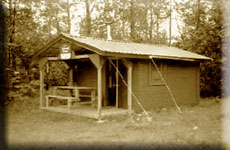
| Yakutat Ranger District | ||
 Alsek River |
 Italio River |
 Situk Lake |
| Cabins | ||
Cabin Name |
Structure Lat/Long and Alt |
Start Long/Lat and Heading |
| Alsek River S (P) (M) (F) | N59 11.27 / W138 25.86 - 28' | N59 11.24 / W138 25.78 - 284* |
| Harlequin Lake N&S S (P) (M) (F) | N59 24.87 / W139 01.72 - 119' | N59 24.87 / W139 01.74 - 088 dirt |
| Italio River S (P) (M) (F) | N59 19.16 / W139 09.30 - 15' | N59 19.16 / W139 09.32 - 070 dirt |
| Lower Dangerous Riv S (P) (M) (F) | N59 24.21 / W139 14.17 - 22' | N59 24.19 / W139 14.18-349* dirt |
| Middle Dangerous Riv S (P) (M) (F) | N59 24.79 / W139 06.71 - 40' | N59 24.83 / W139 06.74 - 142* |
| Situk Eagle & Raven S (P) (M) (F) | N59 33.02 / W139 30.39 - 68' | N59 33.04 / W139 30.38- 162*dirt |
| Situk Lake S (P) (M) (F) | N59 38.24 / W139 22.81 - 147 | N59 38.25 / W139 22.89 - 063* |
| Square Lake S (P) (M) (F) | N59 13.89 / W138 42.82 - 41' | N59 13.94 / W138 42.81 - 172* |
| Tanis Mesa N&S S (P) (M) (F) | N59 14.88 / W138 30.27 - 143' | N59 14.83 / W138 30.18- 010*dirt |
| Back to Top | ||
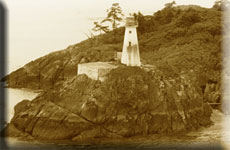
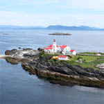
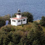
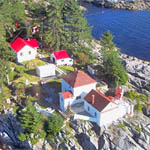
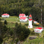
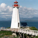
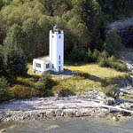
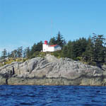
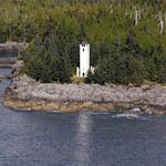
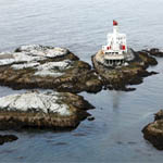
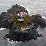
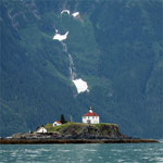
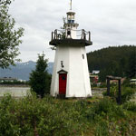
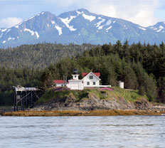
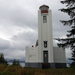
| The Lighthouses | ||
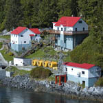
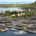
The Lighthouses: The Lighthouses are faithfully represented in the ORBX PFJ and SAK sceneries. Ideally, you should have the latest version of both. Each location has a GPS position for the actual structure and a GPS setting for the "mooring" or starting point."
The photos below of the PFJ and SAK lighthouses and light-stations are from the "Friends of the Lighthouse" website and clicking on the "location name" will take you to their web page for that location. Also, their site has some fascinating old stories about the lighthouses. RTMM highly recommends a visit
|
||
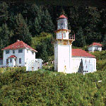
| The Lighthouses added by PFJ | ||
|
Structure: N52 38.57 W128 31.41 |
Mooring: N53 29.61 W130 38.15 |
Structure: N52 11.11 W128 6.70 |
|
Structure: N54 34.15 W130 42.48 |
Mooring: N55 26.78 W131 52.97 |
Structure: N52 16.16 W128 24.41 |
|
Structure: N54 15.33 W133 3.56 |
Mooring: N54 17.79 W130 36.55 |
Structure: N55 05.91 W131 10.98 |
|
Structure: N52 15.69 W128 43.30 |
Mooring: N54 48.14 W130 56.06 |
Structure: N54 17.77 W130 52.90 |
| Back to Top | ||

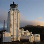
| The Lighthouses of SAK | ||
|
N60 14.25 / W146 38.80 - Flight Plan |
|
|
|
|
|
|
|
|
|
Our thanks to:
for images and links.
|
| Back to Top | ||

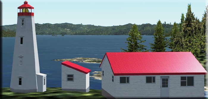
| Mike Mann's British Columbia Lighthouses | ||
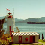
NOTAM From Mike Mann: I include for your enjoyment a selection of eighteen lighthouses from the Pacific Northwest area of British Columbia. The criteria for the selection of lighthouses was that they have a helipad and were staffed and operated by the Canadian Coast Guard. All these light stations are based on their real world counterparts, no fictitious locations are included here. The design philosophy of these light stations was, from the outset of this project, keep it frame rate friendly. The simplicity of the structures and their remote nature help to ensure that frame rates are kept high even on fairly modest powered computers. Although all the lighthouses I have included in this package have a helipad, this scenery will also benefit bush pilots flying coastal British Columbia; lighthouses make great VFR location indicators! Regards, Mike Mann 1. Here is the Original BC Lighthouses File: 2. Here is the UPDATED BC Lighthouses File: (This requires the RTMM Library and Objects 02.11.19 update) 3. BC Lighthouses Light Fix uses my new custom lighthouse light effect. This fix will only work with my BC PNW Lighthouses project. 4. Plan-G file that adds the lighthouses (By Dieter Linde) Special Thanks to Mike Mann from RTMM |
||
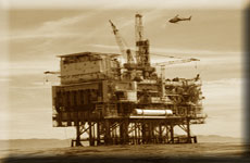
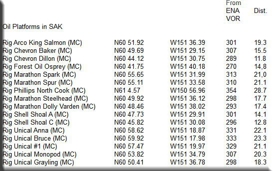
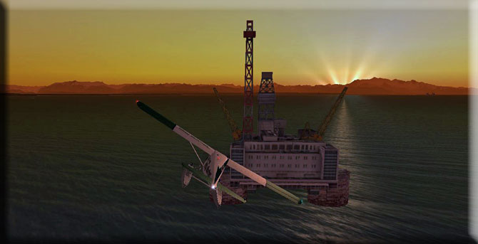
| Oil Rig Platforms | ||
The SAK Software Package from ORBX has added oil platforms in the Kenai area. The "rigs" are the same scenery object, so don't expect to see something "different" when you find one. We are highlighting the rigs because it is an opportunity to sharpen your VOR Navigation skills. We have created a table (below) that gives you the latitude and longitude for the helipads at each oil platform. The table also gives you the radial and distance to fly from the ENA VOR (Kenai). If you use this link Flight Simulator Navigation, you will be able to learn many of the basic skills you will need to become an expert VOR Navigation pilot. Also, to add to your fun, we have created a new MM-Ops location scenery for you (see below). So you can fly from either Kenai Municipal or MM-Ops to "find" and "service" the rigs. Helo Pilots: You can use the Latitude/Longitude data on the table below to position yourself on any helipad on any of the oil platforms. So you can start at a rig ready to fly back to base, or start at one to find another. Float Plane: You can fly from base to the rigs and land nearby the rigs. At MM-Ops there is both a dirt runway (for amphibians) and a float plane dock. If you are looking for a starting position, add one "minute" to the Latitude ... this will put you near the rig using the MAP feature in FSX (NOTAM #1 below), but not start you out on the helipad. Ships and Boats: You can "cruise" to and among the rigs to service them. This would be realistic navigation for a ship or a boat ... you can use the same data an aircraft uses. For a starting/mooring position, add one minute to the latitude and use the MAP feature in FSX (See NOTAM #1 below). Using VOR navigation getting from base to a rig is a good starting training tool. But it becomes more complicated (and more rewarding) to fly from rig to rig, "seeking" a new radial and distance.
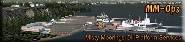
RTMM has added a scenery location called MM-OPS (Misty Moorings Oil Platform Services) near the Kenai airport. From this location you can fly to the rigs with float planes, helicopters or moor ships and boats and travel to them by water. This can be downloaded from the scenery page under "M" for MM-Ops. The package also adds a VOR object you can actually "see" near the airport, positioned at the exact location of VOR ENA.
Flying to the rigs at night can be particularly fun. MM Ops is all "night lighted friendly" ... even with runway indicators as you are landing and taking off that will help you with night time operations. The rigs are "lighted" so they are easy to see and land on, or by at night. Starting locations (using the MAP feature of FSX) allow you to start at an exact point at MM-Ops. The starting points are as follows: • Heli: N60 32.99 / W151 15.93 Mag 340 NOTAM #1: When you click on FSX "Map" ... enter the Latitude and Longitude, set your altitude for 0 (zero), and add in the Magnetic Heading. When you click "OK" to leave the MAP feature, you will be placed exactly where you want to be. For Heli Operations, you can use the Latitude and Longitude given in the table above and this will place you on the helipad at the oil rig. When you have this figured out, then learn how to use the radials and distances from the VOR to fly from rig to rig! (There is always more to learn!)
|
||
| Back to Top | ||
| Special Comments from RTTM | ||
Updating "The Cabins" Page - (What to Expect) With SAK being added, the number of cabins has increased significantly. SAK put in a few of them, but by far, not all of them. If a cabin's co-ordinates are in RED, then that cabin is not yet in the "Missing Cabins" zip file. We will be adding these one at a time, hopefully, until we have them all. When an "area" is complete it will show in the site's NOTAMs. "Still" Missing Shelters. There are four structures that cannot be accessed by aircraft, so these were intentionally left off this list. Flying Misty - In the Air! (M) Maps and (F) Flights: Looking at the Plan-G (M) map will give you a rough idea where the structure is located. If you use the Flight Plan (F), you will see the route on a gps and can either follow the route or take a shortcut of your choice. These routes are not meant for boats, only planes, as they use islands for way points. Cruising Misty - On the Water! (S) Sail Plans and (C) Charts: We are adding an "on the water" aspect to Return to Misty Moorings. We are developing "sail plans" that are safe boating gps routes and "charts"of PLAN-G maps to see the cruise. (The first one of these is for Phocena Bay, you will notice the "S" and "C" at that listing above. "S" downloads the gps route (flight plan) and "C" will either download a detailed Cruise Plan or a Simple Map of the route. |
||
| Back to Top | ||
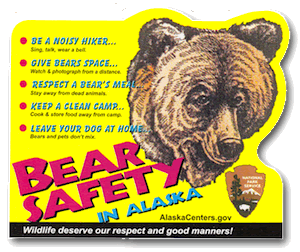
| Bear Safety in Alaska | ||
Here are some things to keep in mind when you are traveling in bear country:
|
||
| Back to Top | ||
 If you're in Alaska, you are probably in bear country!
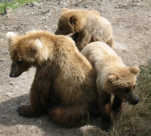