
| The Moorings ... Misty on the Water! | |||
WELCOME to "The Moorings". This section of Return to Misty Moorings will deal with the nautical aspect of RTTM ... ships, charts, boats, cruise routes, and anything related to these. With the PFJ scenery package, we've discovered the scenery "down on the water" is excellent and highly detailed. Holger Sandmann has put in special navigation buoys and markers that are rarely seen from a plane, but usable, accurate and necessary "down on the water." This page, for now, is under development, ... this means YOUR ideas and input are valuable to us ... give us your ideas and comments on the forum: The Moorings - Misty on the Water! RTMM AI Shipping - If you would like to add A.I. Shipping for the RTMM area to you simulator, click on the button below. This takes you to the RTMM AI Shipping Page where you can find all of the information on RTMM AI Shipping.
|
|||
 |
 |
 |
 |

| Cruise Routes & Trips | |||
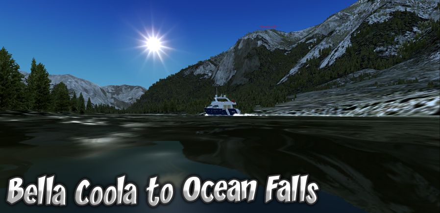
Bella Coola to Ocean Falls
Click to Enlarge |
GPS Sail Plan Bella Coola to Ocean Falls, BC by Doug Linn This is a cruise that can either start at a river anchorage near the airport (up the Bella Coola River, or it can be started from the Bella Coola Marina ... both start points are in the trip tic. The scenery you will encounter on this cruise is spectacular and once out of the river and into the open water, you'll spend most of your time relaxing and just looking around at the scenery. You start down the Burke Channel then cross over to the Dean Channel and continue to Cousins Inlet that leads you to the little community of Ocean Falls. And there really is a falls there. The scenery was so beautiful, I included several screen shots in the Trip Tic.
|
||
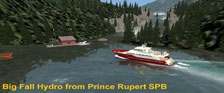
Big Fall Hydro
Click to Enlarge |
GPS Sail Plan from Prince Rupert to Big Falls Hydro This cruise takes you from the Prince Rupert Sea Plane Base down through Morse Basin and Porpoise Bay past Port Edwards and down the Inverness Passage. You then turn into the mouth of the Skeena and then into the Ecstall River that takes you to some fine BBQ at the Brad's by the base of the "Big Fall" waterfall. The trip ticket is a turn-by-turn ticket that will guide you verbally all the way and give you hazards to beware of during the trip. You will pass under bridges on this one (one a railroad bridge). This is mostly a "coastal" run ... no scenery additions except at Big Fall, but the scenery already there is beautiful ... and you'll see two canneries that are in PFJ (that we didn't put in). The trip takes about an hour.
|
||
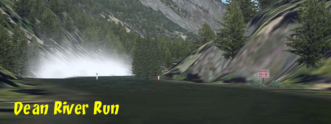
Dean River Run
|
Dean River Run by Doug Linn (July, 24 2011) A multiple location scenery package including a logging/shipping facility, Brad's, Float/Dive Shop, Medical Center for the area, and Emergency Sea Plane Dock. The river is "river-scaped" putting in rocks and rapids where the water anomalies appear ... all of these are documented in the "readme" so you will know how to handle them. Half way up the river is a "Half Way Float Rental Shop" where you can trade your larger boat in for something smaller to navigate the upper river(s). Then, after about 40 miles of beautiful scenery, rapids and waterfalls, you arrive at Sigulat Lake. There you will find Sigulat Lake Village waiting for you. Be sure to read the "readme" carefully ... all of the "mooring points" are listed there (as well as the Map Room).
|
||
Doug's Outfitters
Click to Enlarge |
Doug's Outfitters (and Lodging) (Updated V2.1-06.14.2019) This is a ‘float trip’ set, meaning there are no hazards along the way. No special skills are required. Doug's Outfitters is the central location, comprising a lodge, an outfitters and lodging cabins. This is on a peninsula where the Ecstall River and Sparkling Creek come together. Ecstall River Run: At the headwaters of the Ecstall River is "River's End" a float trip facility that will start you off on a trip from the headwaters back to Doug's Outfitters. There is a short landing zone for float planes and a helipad. Sparkling Creek Run: At Mitt Lake is the "Lake's End" float facility. This is at the headwaters of Sparkling Creek which also takes you back to Doug's Outfitters. Both rivers have been "river-scaped" ... there are guiding buoys along the way as well as turn signs. The read me pdf has more details. Rapids and waterfalls have been replaced with smooth water to make both rivers more navigable. To download, go to the scenery page and download Doug's Outfitters and Lodging Facility under ‘D’. |
||
Grenville Channel Cruise
Click to Enlarge |
GPS Sail Plan from Prince Rupert to Hartley Bay, BC by Doug Linn This is an 80 mile journey, but the autopilot can take you from start to finish. Use “M” in FSX to open your map and enter the start point, including the “heading”. Then proceed to Way Point RWNB on a heading of 51 degrees. At each way point, adjust your course per the Cruise Plan. Our cruise starts out at the Prince Rupert Seaplane Base. We follow the channel markers until we are in open water for about 10 miles going to Kennedy island. we then begin the channel run coming past Marrick Island. You simply follow the channel all the way to its end where you will turn to port and come into Hartley Bay, BC. Some of the most beautiful scenery in the PFJ package can be seen from "water level" coming down this beautiful channel.
|
||
Fountain of Ute River Run
Click to Enlarge |
Fountain of Ute River Run (Added 07.11.2011) By Doug Linn
|
||
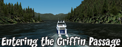
Griffin Passage
Click to Enlarge |
GPS Sail Plan from Bella Bella to Klemtu via the Griffin Passage By Doug Linn Cruise Overview: The cruise starts off at the dock in Bella Bella, BC. (Use the Mooring Start Point). It then tracks out of Bella Bella Harbor into the Seaforth Channel going to Ivory Island and turning to starboard around Ivory Lighthouse into Milbank Sound. The course then takes you up the Mathieson Channel until you reach to turnoff to port into the Griffin Passage. The Griffin Passage is at times wide as a lake and at other times not much wider than the beam of the vessel. You should not run autopilot and be sure to "zoom" in on the rings for the GPS as you will be making some critical turns around obstructions. The Griffin Passage is a beautiful cruise that is unique. In the passage, you will sometimes feel like you are on a pleasant lake, then at other times on a twisting river. After the Griffin Passage, you will enter Sheeps Passage and turning to port will be sailing down the Finlayson Channel to Boat Island. You will turn to starboard passing the Boat Island Lighthouse, then to port to Klemtu passage that is between the shoreline and Cone Island. Klemtu arrives on your port quarter.
|
||
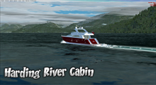
Harding River Cabin
Click to Enlarge |
Ketchikan Int'l Sea Plane Base to Harding River Cabin By Doug Linn Cruise Overview: This cruise starts off at the Ketchikan International Sea Plane Base in Tongass Narrows. The course takes you past Guard Lighthouse, then up the Clarence Strait, going past the Ship's Island Navigation Light and rounds the turn to the east at Meyers Chuck. You then proceed in that direction to Ernest Sound and into the Bradford Channel where you will find the Harding River Cabin. There is a lot of "open water" sailing in this cruise. The length is about 70 miles.
|
||
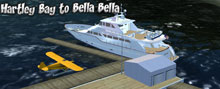
Hartley Bay to Bella Bella, BC
Click to Enlarge |
Hartley Bay, BC to Bella Bella, BC. By Doug Linn Cruise Overview: This cruise starts at the dock at Hartley Bay, BC. You cruise out into Wright Sound. We turn into McKay Reach watching for the Princess Royal Channel. Turning into the PRC, we follow it to Work Island. Passing Work Island, we continue in the PRC until we reach Sarah Head (the leading tip of Sarah Island). Here we turn to port taking the Hiekesh Narrows to Finlayson Head. We then head to starboard to cruise down the Finlayson Channel. We pass by Boat Bluff Lighthouse (which you can stop and see, it will be to starboard), then continue Milbank Sound. Entering the sound, we will stay to the port shiore passing the Gaudin Islands and Boulder Head. The next waypoint is the 2nd lighthouse on this cruise, Ivory Island Lighthouse. At Ivory Island we turn to port up the Seaforth Channel and make our way to Bella Bella, BC.
|
||
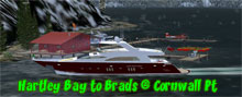
Hartley Bay to Brad's at Cornwall Click to Enlarge |
Hartley Bay to Brad's Cornwall Pt (Added 02.19.2012) By Doug Linn This is a deep water trip from Hartley Bay SPB to the Brad's Bait & BBQ at Cornwall Point. This is an EASY trip, one where you can sit back and enjoy the scenery, perhaps read a little or listen to some good music. The purpose of this sail plan is that it is a leg connecting the Grenville Channel Run (Prince Rupert to Hartley Bay) to the Fountain of UTE (Brad's at Cornwall Point to Xavier's Cabin). You can use this plan as the "middle leg" that will connect you all the way from Prince Rupert to the Fountain of Ute.
|
||
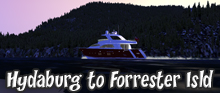
Hydaburg to Forrester Isld R.O.
Click to Enlarge |
Hydaburg to Forrester Island Research Outpost By Doug Linn This trip has two parts, the first is literally running a maze of islands and rocks that populate the Hydaburg area. After you successfully reach open sea, you will see why the mariners that sail this particular part of the area must be very skilled indeed to come and go safely. The second part is basically open sea. You set a course for Forrester Island and the plan will take you directly to the dock of the Research Outpost.
|
||
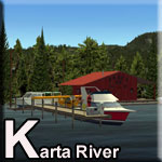
Karta River Run
Click to Enlarge |
Karta River Run (Added 12.30.2014) A pretty river run up the Karta River near Hollis. It starts at the Hollis Brad's BBQ. The Lat/Long is in the readme. Use your MAP feature to position your watercraft at Brad's. You can fuel up while you are there, the pumps are working. Enjoy the trip up the river. There are four way points on the river, Karta River Cabin, Karta Lake Cabin, walker Home and your final destination, Salmon Lake Cabin. The river is "river-scaped" so you will see many other things along the way.
|
||
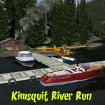
Kimsquit River Run.
Click to Enlarge |
Kimsquit River from the Logging Camp to Victory Valley
This package gives you "water-scaping" for the Kimsquit River. It adds a starting cabin/pier near the Logging Camp and takes you up to Victory Valley with all navigation markers, wildlife, rapids et al in place.
|
||
Misty Moorings River Contest
Click to Enlarge |
Misty Moorings River Contest - By Xavier Carre
This is an amazing river racing layout for a spot on the Dean River. This comes complete with all kinds of great effects that you must see if you like to be down on the water! Read the pdf carefully that comes with this for the amazing details of this package.
|
||
Phocena Bay
|
From Misty's Place to the USFS Phocena Bay Cabin By Doug Linn GPS Sail Plan from Misty's Place to the Phocena Bay Cabin. This is a short and simple cruise from Misty's Place to the USFS Phocena Bay Cabin. It can be done with small to medium sized vessels. On this cruise, you get to go by the Misty's Old Yacht Club and see two shipwrecks along the way. The shipwrecks are there because they weren't paying attention to their charts and were just enjoying the beautiful PFJ scenery! There are many small islands and rocks that you must steer clear of on this little trip. If your vessel is prepped for autopilot, this plan will take you from Misty's to the Phocena Bay Cabin, hands off.
|
||
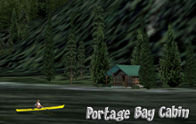
Portage Bay Cabin
|
Portage Bay Cabin = from Hydaburg to Portage Bay (03.31.11) by Doug Linn Portage Bay ... So named because of it's very important geographical positioning. In days gone by, the cabin site was used as a staging area for the portage of 2.8 miles between the end of Portage Bay and the West Arm of the Cholmondelay Sound. (Topo in the Trip Tic). This means it was only a short walk along a well-worn path along Portage Creek to the "other side" of this large island. To go around the island by boat required a sailing trip of 100 miles rounding the island to the south and almost 150 miles going around the north end. So a 2.8 mile "portage" became a popular shortcut for people "back in the day." This cabin is positioned on the staging site, a nice flat piece of land where barges could unload their cargo for the portage.
|
||
Spud's Creek
|
Spud's Creek (Added 02.14.2012) A short "river run" ... good for beginners. You can start in the Stewart Area and ride down the Portland Canal, or start at the Brad's BBQ at the mouth of Spud's Creek. The starting point is in the Readme and it is also at the Map Room at Misty's Place. Scenery includes wildlife, camping and cabins along the way. See the readme for full details.
|
||
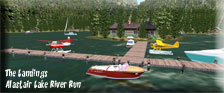
The Landings River Run
|
The Landings at Alastair Lake (Updated 04.28.2012) by Doug Linn A medium sized river run going from Brad's BBQ on the Skeena River up to Alastair Lake. This is a winding river up a beautiful, flat river valley, finally opening up into Alastair lake. You then go about 3 miles on the lake and come to the Lodge. You should start at Brad's BBQ at Skeena River. Once there, head behind Brad's up the river. Follow the buoys keeping the red ones to your right, green to left. You will eventually arrive at Alistair Lake where there is a lodge at the far end. There is plenty to see along the way, the river has been "river-scaped". Hope you enjoy the trip.
|
||
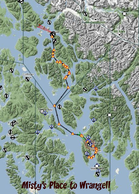
|
|
GPS Autopilot Route from Misty's Place to Wrangell by Jeff Greene. This cruise is meant for a vessel equipped with autopilot. This route will take you safely from the Misty's Place Seaplane base to Wrangell. This is a "hands off" auto route. There is also a return route in the download file.
|
||
Yes Bay to Helm Bay Cabins
Click to Enlarge |
Yes Bay Lodge to Helm Bay Cabins By Doug Linn Cruise Overview : This cruise starts at the Yes Bay Seaplane Base. It travels through the Yes Bay Narrows then out into the Behm Canal where we turn to starboard and head down to Helm Bay, about 20 miles south of Yes Bay. We then turn into Helm Bay and head for the first cabin that is located near Force Island. The course then changes a little to starboard to head across the bay to the second cabin at Helm Bay. If your vessel is prepped for autopilot, then it will track this gps route safely.
|
||
| Back to Top | |||
 Click to Enlarge


| Marine Maintenance Shop (Tips and Tweaks for Boats) | |
DeltaSim's Smit Rotterdam Tug |
Smit Rotterdam Tug - Autopilot Fix (Added 03.29.11) Here is the latest "tweak" Jeff has put onto the Smit Rotterdam Tug. This give the boat excellent autopilot capabilities. NOTAM: Be sure to first rename you aircraft.cfg and panel.cfg ... then add these to the proper places. Also, this is only "the latest beta" ... there may be more adjustments and if this file gets updated, it will show a date for the update above.
|
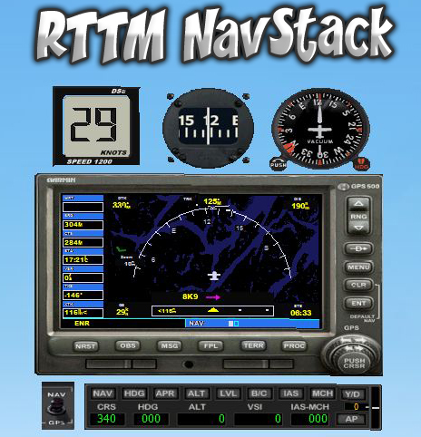
NavStack from RTTM
Click to Enlarge |
RTTM NAV_STACK (Added 04.01.11) This is basically a "minipanel" for a boat. It allows you to have the basic information you need while in the "outside spot" view ... which is the preferred way of sailing the boats. (The view in PFJ is so spectacular, you don't want to be looking through a "hazed" window!). If you have a special autopilot config (which you can get here for some models), the NavStack is "autopilot ready." In the heading mode, just like in the planes, you can alter the heading of the aircraft by tweaking the knob on the heading indicator. Also, there is a nav/gps switch that allows your boat to track a gps heading. NOTAM: all of this is strictly experimental, but a lot of fun to try. In the "zip" below, a readme tells you how to do it, and it is relatively simple. If it doesn't work, call Microsoft. And if you have suggestions, let us know ... some call this "developmental" we call it "Fun!"
|
| Back to Top | |
Scirocco Autopilot
Click to Enlarge |
From Jeff Greene (03.31.11) Here is an autopilot (Config files) for the FREEware Scirocco. This is our first "freeware" model, so now you don't have an excuse to try "Misty on the Water!" Click on the ZIP icon to download the config files from Jeff. You can get the free download of this yacht from Deltasim in the link under The Marina
|
| Back to Top | |

| Interesting Mooring Starting Points | |
NOTAM: Mooring points for all RTMM Sceneries can be found in the Map Room, USFS Cabins in The Cabins. |
|
| Bella Bella, BC (Dock) | N52 9.80 W128 8.46 Heading 157 |
| Bella Coola Airport Anchorage in River | N52 23.32 W126 35.74 Heading 244 |
| Bella Coola Marina at Pier | N52 22.35 W126 47.66 Heading 350 |
| Craig, AK (dock) | N55 28.86 W133 8.52 Heading 263 |
| Gitwinksihlkw, BC (Nass River) | N55 11.50 W129 13.29 Heading 039 (By the bank, no pier yet!) |
| Greenville, BC (Nass River) | N55 1.72 W129 34.49 Heading 163 |
| Hydaburg SPB Pier | N55 12.66 W132 49.78 Heading 231 |
| Klemtu, BC | N52 35.64 W128 31.29 Heading 105 |
| Ocean Falls at Pier | N52 21.20 W127 41.68 Heading 241 |
| Back to Top | |
| The Marina - FREEware! | |||
|
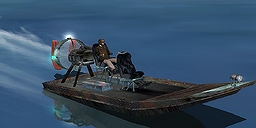
Airboat 1 Gator Bait Download HERE. This is a FREEware boat and perfect for running up the rivers. It has a great little instrument panel ... rustic as can be and works very well. An excellent model. NOTAM: We can't get the original download link to work nor can we "log in" to this site now. We've asked for instructions, waiting to hear. If anybody knows how to contact this site, let us know. |
||
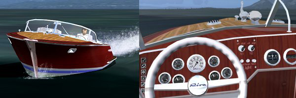
Riva Aquarama by HAMA This is the classic RIVA AQUARAMA by "Hama". This is a beautiful boat, it is freeware. There is a "driver" for this one and if you can find the button even some eye candy in the back seat! This is a great boat for RTTM. You can download it HERE |
|||
|
Scirocco FREEware from Deltasim This is 3DS MAX motor yacht model designed for Microsoft Flight Simulator X. With the coming of new simulator, we got new unlimited possibilities to build very detailed objects where old, light weight FS9 models are history. In this case model has over 30 Mb, but it is not comparable with old stem, - need divide by 3 about. Sirocco LT (light) is a concept motor yacht, it has virtual cockpit with custom gauges, moving parts, very detailed marine equipment, new materials, new lights and DirectX textures. The boat is designed ONLY FOR FSX and it is not compatible back. You can download it HERE |
||
| Back to Top | |||
 Click to Enlarge